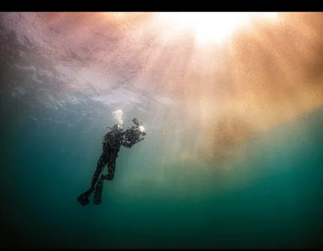
National Geographic Special · November 2026
Our One
Our One
Ocean
Five named oceans, one connected system. Explore nine real expeditions, then try being a scientist and a Polynesian navigator in our simulators.
Five named oceans, one connected system. Explore nine real expeditions, then try being a scientist and a Polynesian navigator in our simulators.
National Geographic and Rolex’s Perpetual Planet Ocean Expeditions sent Explorers to all five ocean basins. Here is what they found.
Six hands-on simulators built from the magazine’s own graphics. Steer a canoe by the stars, replay 4,000 years of voyages, build a stick chart and run a mangrove experiment.
Navigators divide the horizon into 32 houses. A star always rises in one house and sets in the house with the same name on the opposite side. Pick a star and a latitude, then press play to watch it cross the sky.
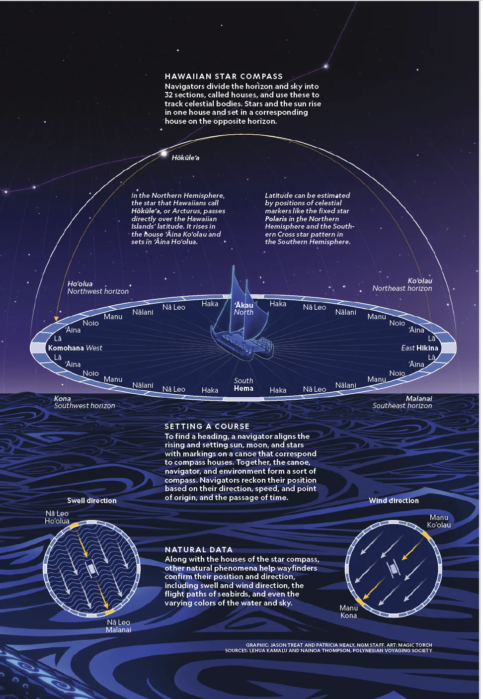
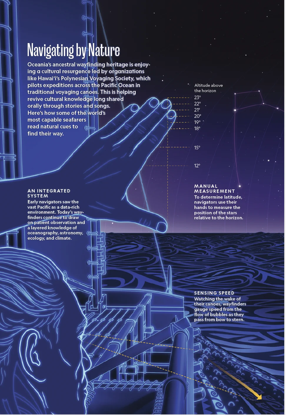
The higher Polaris (the North Star) sits above the horizon, the further north you are — its height in degrees roughly equals your latitude. Hold your fist at arm’s length: one fist is about 10°. In the south, navigators use the Southern Cross. Sail the canoe between Tahiti and Hawai‘i and watch the sky change.
Over 4,000 years, seafarers settled islands across about 9,000 miles of the Pacific in two great waves. Drag the timeline or press play to watch the canoes go.
Base map: Matthew W. Chwastyk & Patricia Healy, NGM staff · Sources: Patrick V. Kirch, University of Hawai‘i at Mānoa; NOAA; NASA/JPL · Animation by LibNext
Marshallese navigators made charts from sticks, coconut fibre and shells. Shells mark islands; curved sticks show how ocean swells bend and bounce around them. Tap the sea to drop islands, change the swell, then switch to stick-chart view.
💡 Where bent swells from two islands cross, the water gets choppy. Navigators feel these “knots” in the canoe’s hull and know land is near — even beyond the horizon.
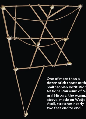
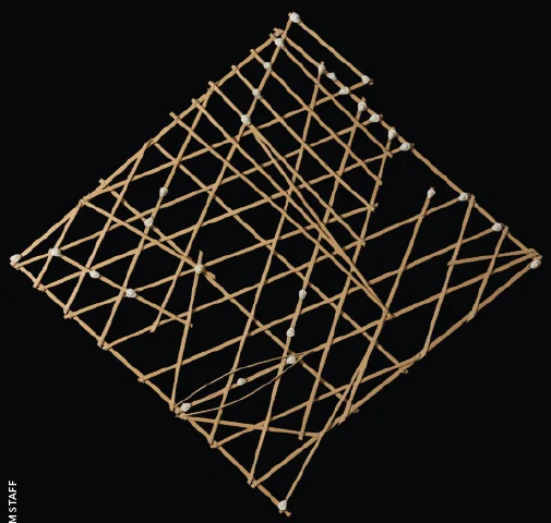
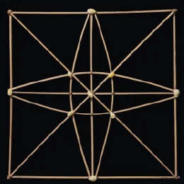
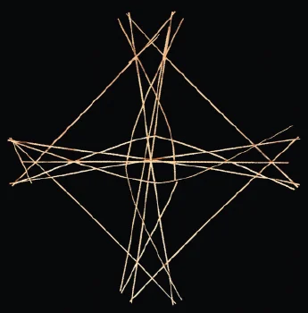
Photos: Rebecca Hale, NGM staff · Charts held at the Smithsonian Institution’s National Museum of Natural History
Red mangroves on the Gambia River need a balance of fresh river water and salty seawater. Raise the sea level, change the rains and plant seedlings to see how the forest responds.
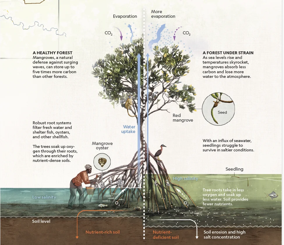
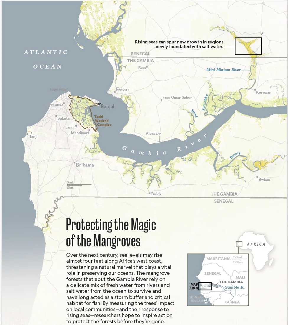
Graphic: Soren Walljasper, Monica Serrano & Brandon Shypkowski, NGM staff · Sources: Betty Jahateh, East Carolina University; Maiyai Taal Hocheimy, GREAT Institute; Lola Fatoyinbo, MIT; Zhen Zhang, Tulane University; NASA Earthdata; ESA
National Geographic cartographers made a new map projection that shows all the oceans as one continuous body of water. Tap the glowing points to explore currents, cycles and changes.
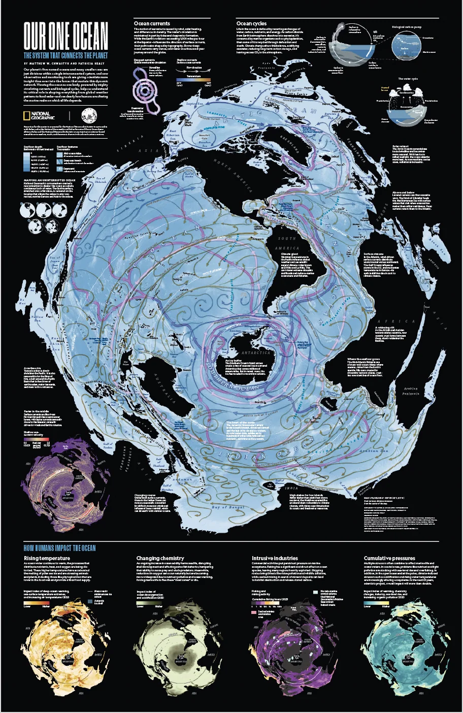
Poster: Matthew W. Chwastyk & Patricia Healy, NGM · © 2026 National Geographic Society · Supplement to National Geographic, November 2026
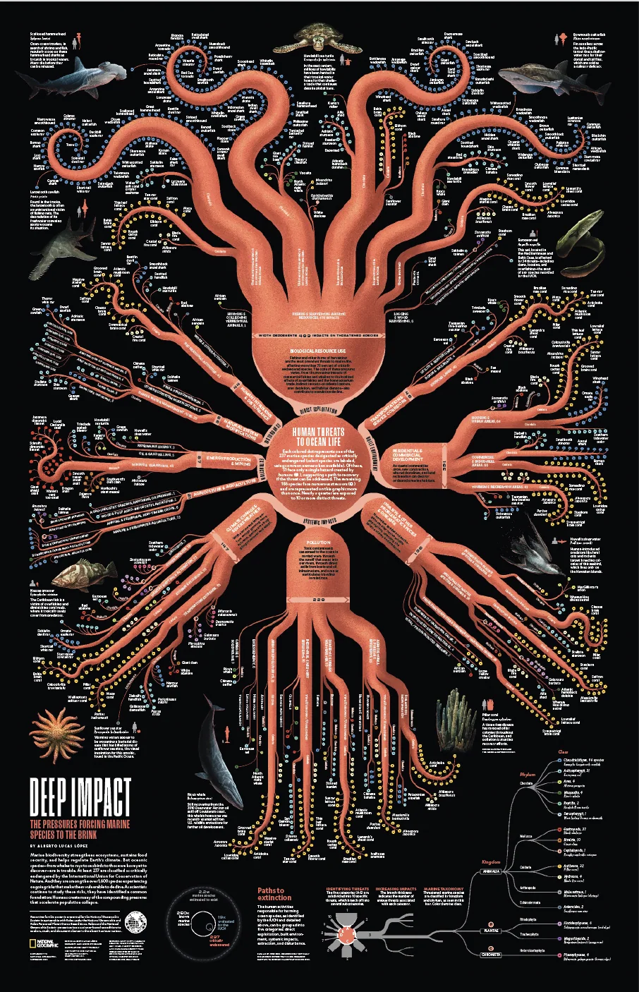
At least 237 marine species are critically endangered. Each arm of this octopus is one kind of human threat; the thicker the arm, the more links it has to those species. Tap an arm to explore.
From Arctic sea ice to the tropical Seychelles, scientists fanned out across all five ocean basins. Tap a diamond on the map.
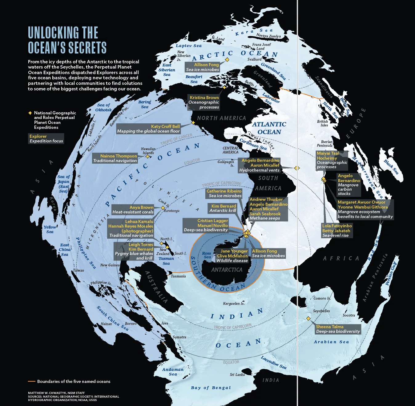
Map: Matthew W. Chwastyk, NGM staff · Sources: National Geographic Society; International Hydrographic Organization; NOAA; USGS
Ten questions from the stories and simulators.
Content on this page is adapted for students from National Geographic, November 2026, Vol. 250, No. 5 — “Our One Ocean”, published by National Geographic Partners, LLC. The articles here are retold in LibNext’s own words. They are summaries, not the original texts — read the full stories in the magazine or at nationalgeographic.com.
Reporting in the issue is presented by the National Geographic Society in partnership with Rolex under the National Geographic and Rolex Perpetual Planet Ocean Expeditions.
National Geographic is a registered trademark of National Geographic Society. LibNext is not affiliated with or endorsed by National Geographic.